Bajnok utca 13
1063 Budapest
keller-raffl.com
Your Custom Text Here
Your Custom Text Here
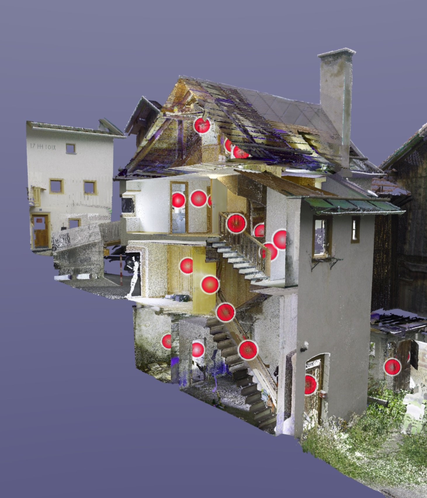
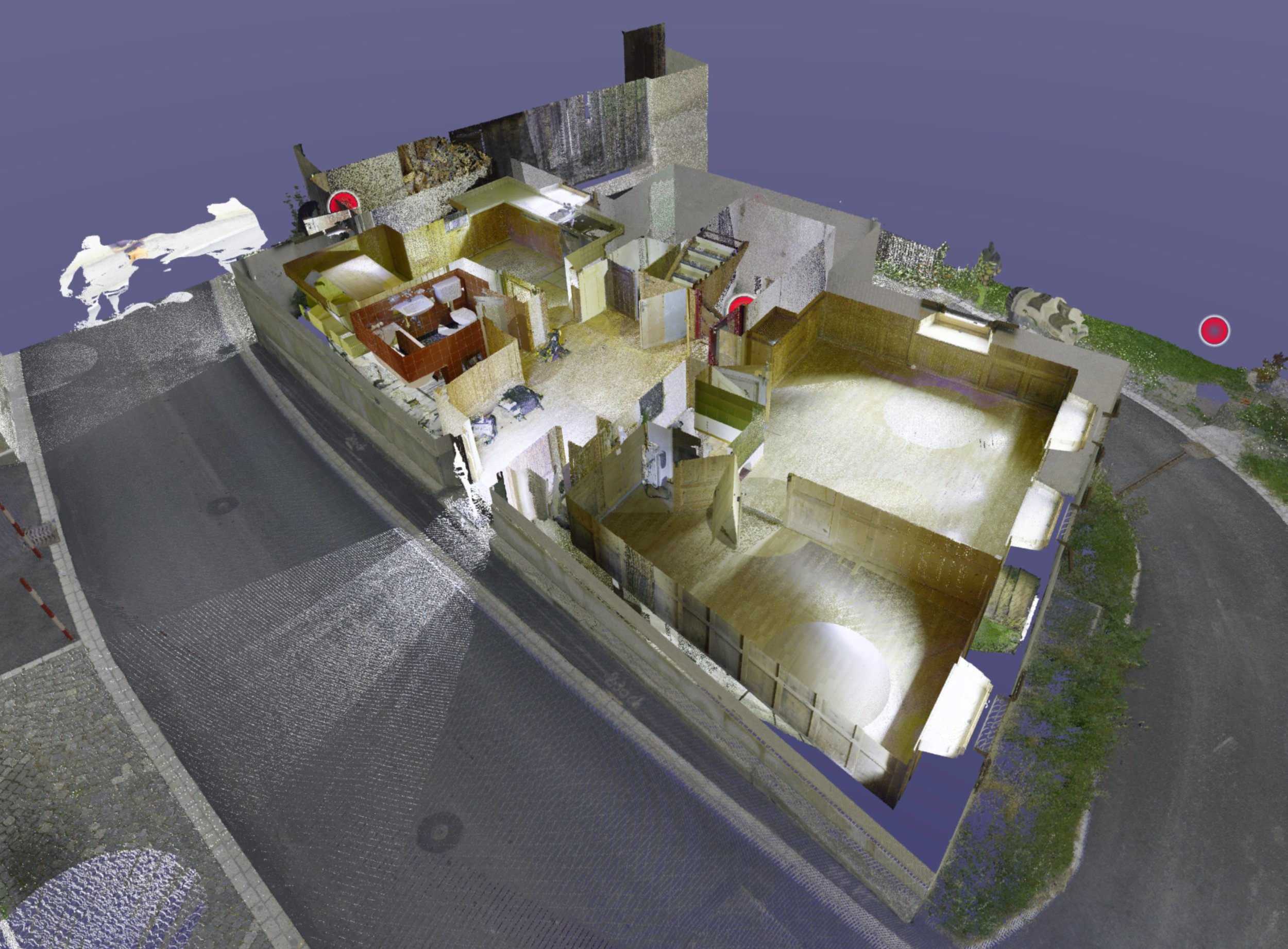
Scanning entire buildings
Scanning of cable runs
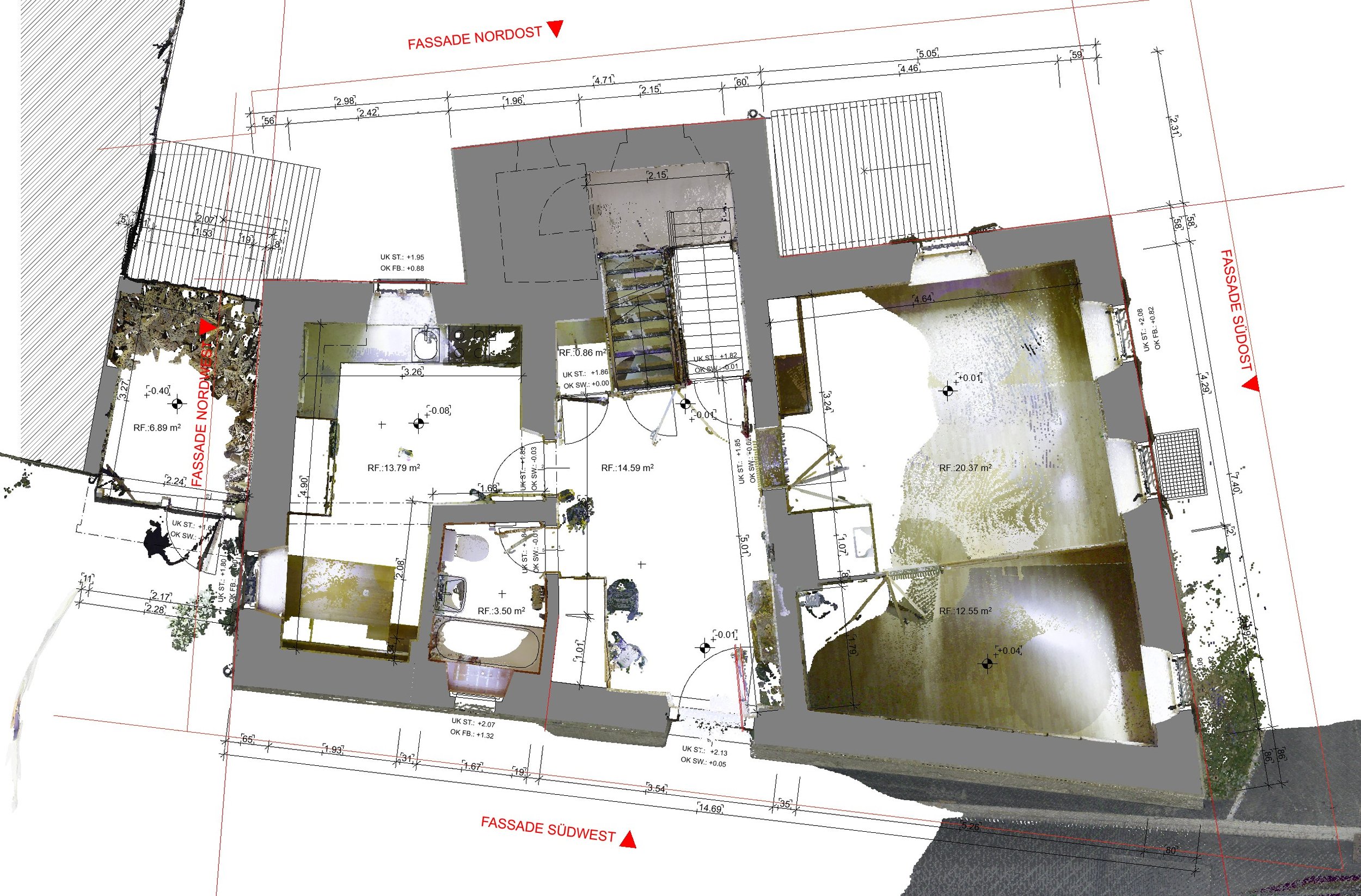
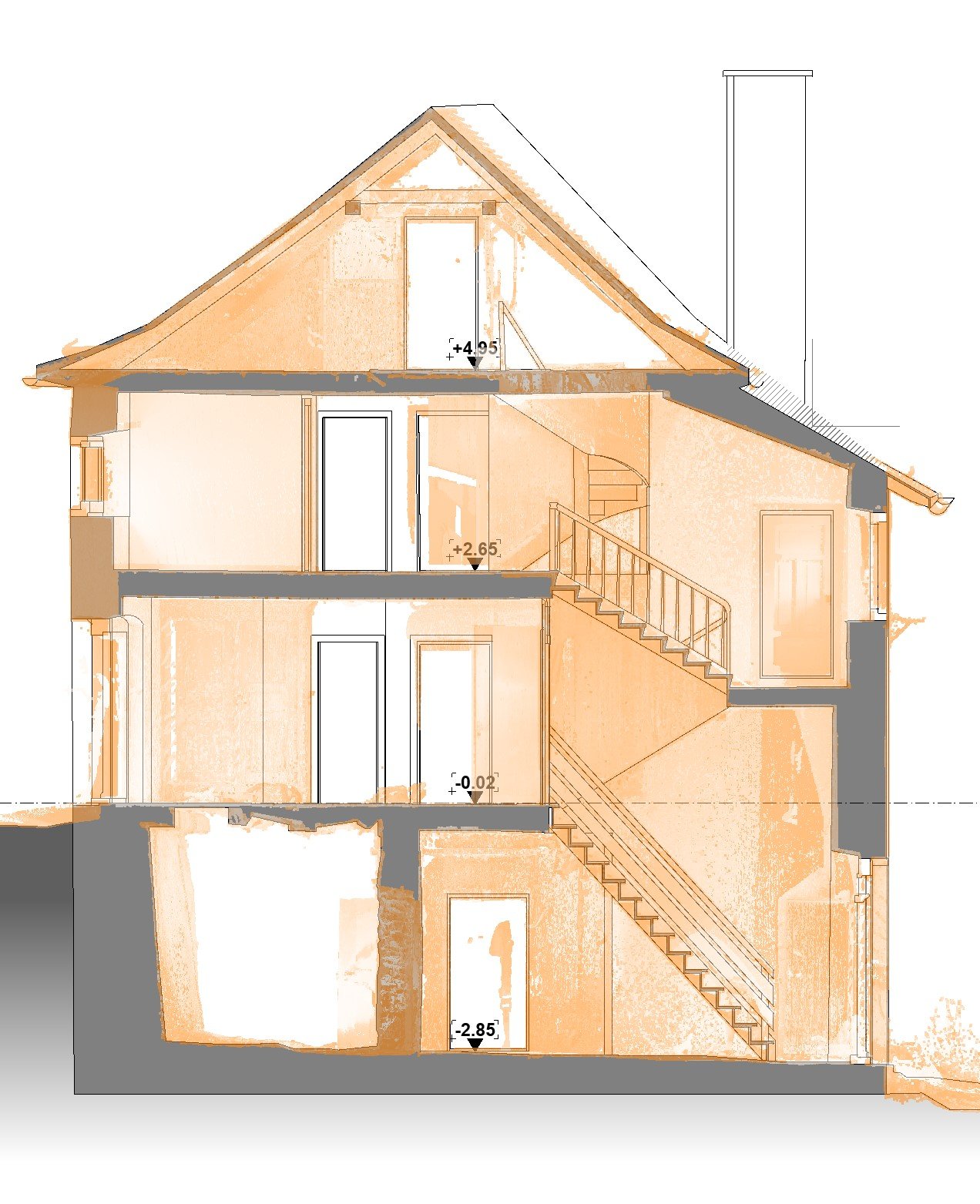
Building 2D or 3D models
Publish point cloud in the web viewer
Georeferencing
Measure wall thickness and wall structure
drawing multi-layer walls
Scan tunnels or corridors
Combination with other products
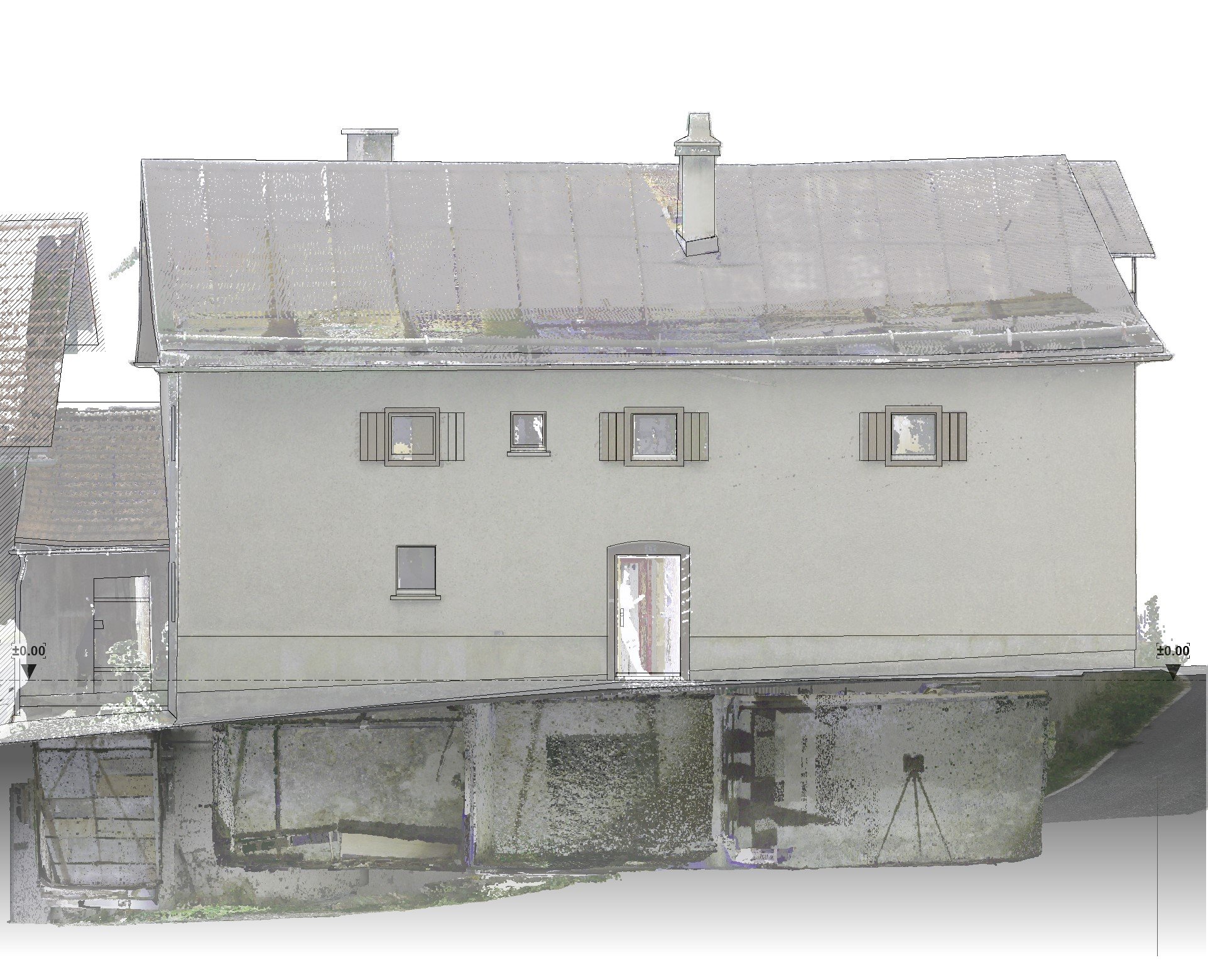
Scanning a building requires thorough work preparation so that important objects are captured with the necessary accuracy. In every room, as well as outside and by drone on the roof, millions of points are measured in a grid of 0.5 - 4cm, which together represent the entire building. Depending on the order, the dots are colored or left as a grayscale image.
However, since the points only have X/Y/Z coordinates, we create a 2D or 3D model with manipulable elements from the pile of points. The level of detail (LOD, LOI, required components, etc.) will be discussed and explained with you in advance.
Depending on the workflow, the pure referenced point cloud files that can be read into most CAD systems are sufficient.
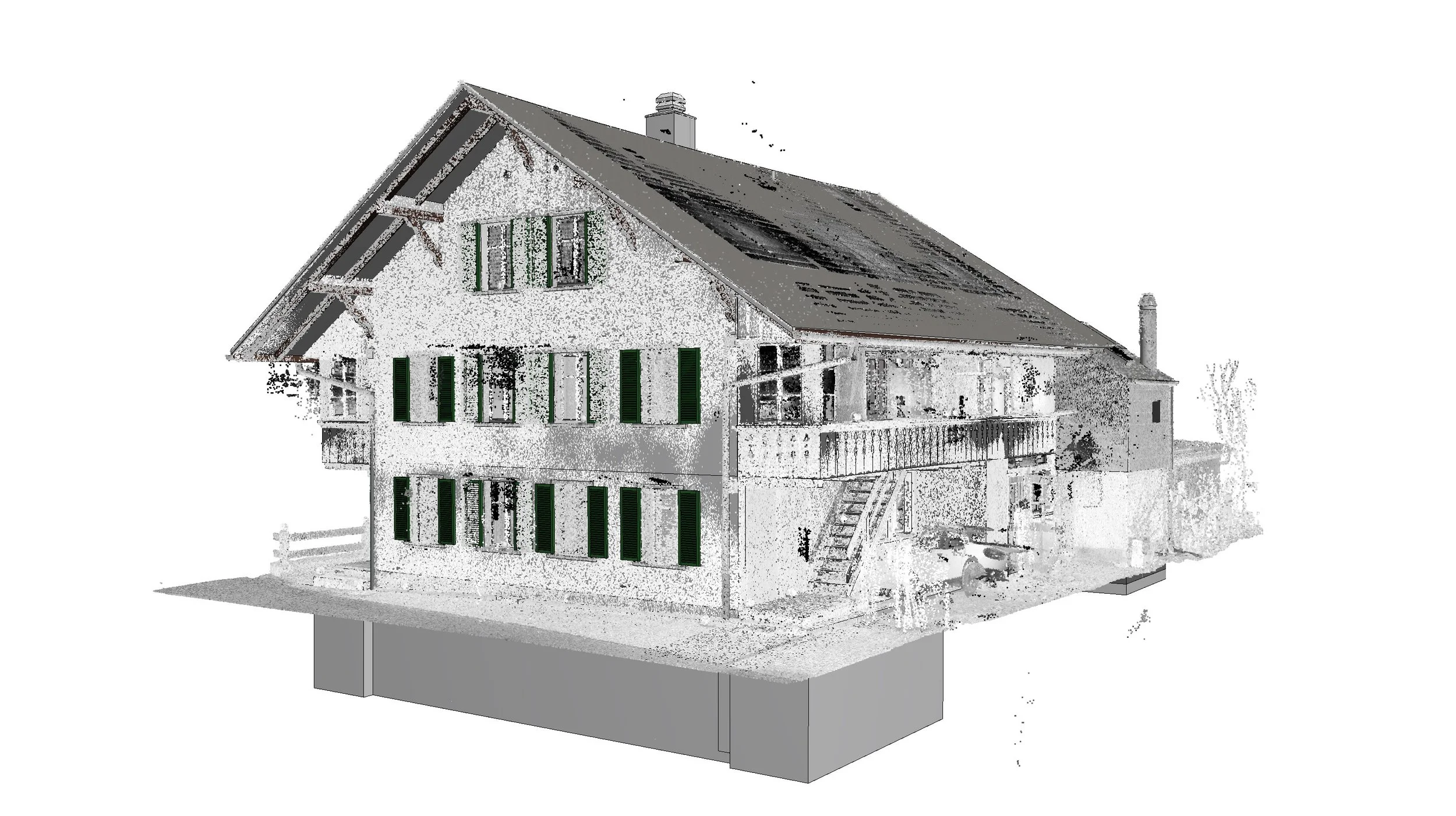
The web viewer enables our customers to view ongoing projects in great detail and to be up to date at all times. You can see the floor plan of the property as well as the details inside and around. This is thanks to the many scanning stations that are set up all around and in the building. The customer can take action on the desired object himself, for example he can measure distances, add labels and create categories.
Point cloud
Individual position and height recordings of various objects
Volume measurement of buildings
Addition to existing recordings and 3D models
Measure wall thickness and wall structure
drawing multi-layer walls
Measure and display tunnels or corridors
Combination with other products
Are you still missing information to finish planning the construction? In some cases, individual dimensions and heights are sufficient, which we supply to you in a local or national coordinate system.
We supplement the existing building model with the required information or check it for deviations.